
Trace a Livonia Street by Address
A street-by-street search works best as a record trail, not as a roster. The assessor record ties a listed tax owner to a situs address and parcel. The map fixes that parcel on the ground. The deed index then connects the owner to an instrument, while voter and historical sources can provide limited, dated context. Owner and mailing addresses may differ, and a tax owner may not live at the property. Treat each match as one part of a documented address history.
- Search the address in Livonia Online Property Inquiry and open the BS&A result. Record the situs address, owner or entity, tax year, parcel/PIN, legal reference, and any service links shown.
- Open the City of Livonia Parcel Map. Turn on parcel and address labels, then use the parcel geometry and PIN to check the exact location.
- Use the owner name and legal description in Wayne Public Search. Search the owner as grantee, read the prior grantor, and verify the legal description before stepping backward.
- For one named person, use the Michigan Voter Information Center as an individual confirmation tool. It is not a browseable street list.
- For an older household, compare a dated telephone or reverse-directory entry with the deed and parcel trail. Keep the source date with every name.
That sequence keeps the Livonia street directory grounded in records that are keyed to the address. It also avoids treating one result as proof of an entire household.
Livonia BS&A Street Directory Fields
Livonia BS&A Online Property Inquiry is the primary address entry point. Livonia advises searchers to omit a road suffix when that format fails, so a number and street name may work better than a fully written suffix. The guide also permits an address range, although a range is a bounded way to inspect parcels, not a promise of a complete street list. Search by owner name, parcel number, utility account, or building record only when the record type fits the question.
| BS&A field | Type | Needed? | Livonia street use |
|---|---|---|---|
| Address or address range | Text | Alternative | Locates one parcel or a limited sequence; omit suffixes when the city tip applies. |
| Owner or name | Text | Alternative | Finds tax-owner records and does not establish all occupants. |
| Parcel number or PIN | Text | Alternative | Bridges the map, tax record, and deed notes. |
| Advanced address search | Checkbox | Optional | Refines address parsing when a basic search is too broad. |
| Building record number | Text | Optional | Accepts permit, enforcement, certificate, or project numbers where available. |
The assessor page warns that online information is not warranted for accuracy or completeness. Current-year tax collections remain the official record at City Hall, and a screen is not the original tax bill. A homestead exemption can be an occupancy clue, not a guarantee. Keep a dated note of what the result displayed.
See the BS&A Livonia property inquiry before using the assessor search controls shown here.
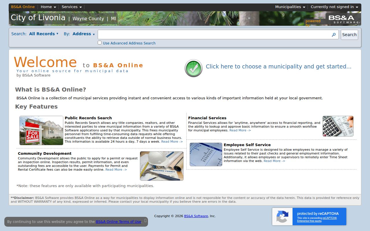
The assessor screen is useful for moving from a street address to the parcel record. It does not turn a tax owner into a verified current resident.
Map a Livonia Street Parcel
The parcel viewer supplies the spatial check that a text search cannot. Its public map and REST service expose Tax Parcels, Address Text, Parcel Full PIN Text, Parcel Lot Text, subdivision boundaries, and road layers. Zoom to a street segment, enable the labels needed to orient the result, and use Identify or Query where the layer permits. Copy the full PIN as displayed instead of trying to infer its format.
A parcel polygon shows land geometry, not a list of people. It can reveal adjoining lots, named subdivisions, streets, water, drains, and quarter-section lines. Use BS&A for assessment details and the Wayne County Register of Deeds for recorded instruments. The inspected map does not document a historical coverage date or a one-click resident-radius tool.
Open the Livonia aerial parcel viewer to see the map controls and parcel layers.
Use the map image as a reference for the parcel-to-address workflow, then preserve the PIN and legal description with the deed research notes.
Livonia Address Records at a Glance
Several custodians hold address-keyed pieces of the same street story. The strongest bridge is the parcel/PIN and legal description, because a street name or mailing address can change. The records below have different access limits and should not be blended into a claim that everyone at an address is publicly listed.
| Address record | Keeper | What it can show | Access route |
|---|---|---|---|
| Assessment and tax card | Livonia Assessment / BS&A | Tax owner, situs, mailing address, values, exemptions, PIN, service links | Free inquiry; official record at City Hall |
| Parcel map | City of Livonia | Geometry, address/PIN labels, roads, subdivisions, adjacent parcels | Free map and REST identify/query tools |
| Deed index | Wayne County Register of Deeds | Grantor, grantee, recording date, document or liber/page reference | Limited free name index; expanded paid, office, or mail route |
| Building or inspection record | Livonia / BS&A | Permit, inspection, enforcement, certificate, or project references if published | BS&A or city FOIA; coverage not located |
| Voter registration | Michigan Secretary of State / Livonia Clerk | One public registration result or defined geographic request | MVIC individual lookup or QVF FOIA request |
| Historic directory and newspaper | Livonia Public Library | Dated household, phone, move, obituary, and notice clues | Digital collection, microfilm, and library research routes |
When a permit or code series is absent from the public screen, submit a focused request through Livonia's public-records request form. State the parcel or address, record type, and date range. Michigan Freedom of Information Act requests are more useful when they identify a record series rather than ask for an undefined dossier.
Follow a Wayne County Deed Chain
Recorded deeds establish an instrument trail, not an occupancy roll. Take the owner, PIN, and legal description from the parcel record. Search that owner as a grantee in Wayne Public Search, then read the seller, recording date, and document reference. Search that prior seller as a grantee and repeat, checking the legal description at every handoff. A seller may be an estate, trust, company, or several co-owners, so preserve each party before deciding what to search next.
The free web index is name based and begins January 1, 1960. Expanded portal access can search address, legal description, parcel/tax ID, and liber/page. For an earlier instrument, use the Register of Deeds office, mail search, deed books, tract books, plats, or archive route. In-person service has required an appointment since October 1, 2025, so confirm the current process before a visit.
Visit Wayne Public Search for the current deed-index entry point and Property Alert information.
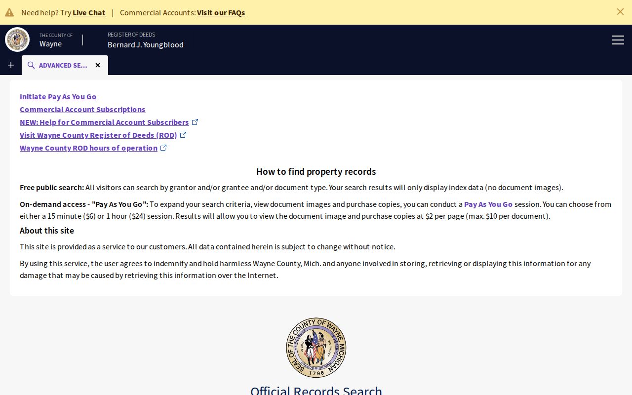
The portal image shows the current county search entry point. It is a starting place for an instrument trail, not proof of who lives in a home today.
Livonia Voter Clues by Street
Michigan Voter Information Center is designed for one person at a time. Its name route asks for first name, last name, birth month, birth year, and ZIP code, while an alternate route uses a driver's-license number with birth information. It can help verify an individual registration record after an address trail is already established. It does not offer a public whole-street browse, and a registration result is not proof that every person at an address currently resides there.
Michigan voter records are public through FOIA, but significant fields are withheld, including full birth date, phone, email, signatures, driver-license or state-ID numbers, and protected information. A Qualified Voter File request is a formal geography request that can select a city, ward, precinct, or other defined geography. It does not promise a street-level extract, and redactions apply.
Use the Michigan Voter Information Center for its individual lookup form.
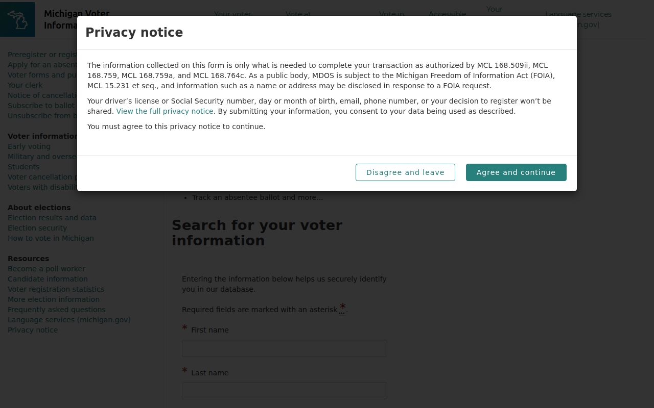
The form illustrates an individual verification route. It should not be used as a reason to compile a street roster or expose protected information.
Livonia Road Names Need Variants
Road history is a practical search tool in Livonia. The city road-history material notes that Middle Belt may appear as Middlebelt, while Newburgh has a long Newburg spelling history tied to the former village near Ann Arbor Trail. A historic entry may also use a village reference such as Livonia Center or Clarenceville. Search the modern and earlier forms, preserve the wording found in the original record, and bridge them with a lot, block, parcel/PIN, or nearby road.
Insider tip. Build the alias list before opening a historic deed or directory. Include road suffix variants, Newburg/Newburgh, Middle Belt/Middlebelt, and the relevant village name. Adding those local forms is more reliable than broadening a person-name search without an address anchor.
Note: An official citywide street-renumbering project and a comprehensive renumbering year were not located in the inspected sources.
Historic Livonia Street Directory Clues
A historic address listing is a dated clue, not a modern contact list. The digitized November 1950 Livonia telephone directory records names, local addresses, four-digit local numbers, and occasional title or occupation notation. Its reverse or street section can connect an address to a head of household, then the alphabetical section may reveal another entry. The record becomes stronger when paired with the deed date, parcel description, newspaper, census, obituary, or cemetery evidence.
- Parcel
- A defined piece of land in the tax and map system, commonly tied to a PIN.
- Situs address
- The physical location of a parcel, which can differ from a tax mailing address.
- Plat
- A recorded map that lays out lots, blocks, and subdivisions used in legal descriptions.
- Criss-cross directory
- A reverse directory arranged by street or address rather than by surname.
The library's older directory and microfilm material can add context to a past address. For collections and reading methods, the Livonia city directories provide the fuller historical route.
Livonia Permits and FOIA Requests
BS&A can link property, tax, building-department, inspection, enforcement, and utility-billing services as applicable. A building-record number can be used for a permit, enforcement, certificate, or project record. Yet the inspected city material did not identify universal public dropdowns or a citywide historical coverage date for permits and code cases. A missing result is not proof that no municipal record exists.
Ask for the specific series through the city's FOIA process when the portal does not display it. Give the address or parcel/PIN, the kind of record, and a date range. The Michigan Freedom of Information Act guide describes the statewide request framework, while the city routes its own records request. Keep utility accounts out of a people search because customer identities and private account lists are not public.
Why Wayne's 1960 Line Matters
The county says its land-record archive reaches to 1703, but its public online deed index begins January 1, 1960. That is a major Livonia street-directory limit for older addresses. A pre-1960 deed can exist without appearing in the same search screen as a later instrument. Do not assume an empty web result ends the chain.
Myth: every Wayne County deed is searchable through one free web field. The free index is limited to grantor or grantee name searching. Earlier instruments and address, parcel, legal-description, or copy work may require expanded portal access, an office appointment, mail search, or county books and tract records.
Livonia Street Search Boundaries
A Livonia street directory cannot show every household member, an unlisted occupant, private utility customer, sealed voter detail, DMV address, or a guaranteed current occupant. The Michigan Address Confidentiality Program can provide a substitute address for qualifying survivors, and protected locations must not be reconstructed from other records. A tax owner, voter record, and old directory entry each describe a limited point in time.
When the task shifts from an address to verifying one person, use separately sourced records and respect their access rules. The property and civic trail is strongest when it stays tied to a specific record, date, and custodian.